Dingle Dunquin and the Great Blasket

30 May 2023
The North Atlantic Arc Home
| May | June |
| S | M | T | W | T | F | S |
| 29 | 30 | 31 | 1 | 2 | 3 | |
| 4 | 5 | 6 | 7 | 8 | 9 |
 |
|
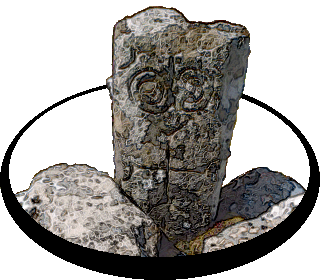
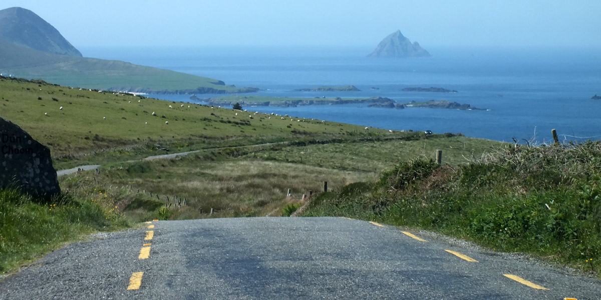
Tuesday 30 May 2023--There is plenty to see around the Dingle Peninsula, and we have an excellent guide (that would be Bobby) who wants to show us things that are a bit off the usual tourist trail. He starts by taking us to a Famine cemetery on a hillside above town. "I thought this would be a pleasant way to begin a trip," says he. Can't go wrong with social catastrophe. The Great Famine of 1845-52 is perhaps the central event in modern Irish history, with widespread and long-lasting consequences. It hit hardest in this southwest part of the country. Everyone knows that potato blight was the nominal cause; the dependence of tenant farmers on that single crop barely hints at the policies and practices that brought the disaster about. The arrogance and callousness of the British government and absentee English landlords is almost beyond belief. On to more cheerful things. We have a look at the medieval Garfinny Bridge. An interpretation board notes that Arthur Grey, Lord Deputy of Ireland under Elizabeth I, likely crossed the bridge on his way to the massacre of 600 Irish rebels and their Spanish and Italian supporters at the Siege of Smerwick. Uh, that wasn't very cheerful. Our next stop is the beach at Bín Bán (or Binn Ban or Beenbane or Beenbawn), just outside Dingle Harbour. (I do not immediately find any horrible historical facts about this beach, which of course does not mean that none exist.) We can see Dingle Lighthouse, built in 1885, at the mouth of the harbor, and Eask Tower on the hill across the water. The tower was a Famine-era make-work project, serving as a navigational beacon for sailors looking for the somewhat obscure entrance to the harbor. It's a clear enough day for us to spot Skellig Michael, 27 miles to the south. Off we go to Dunquin, at the western tip of the Dingle Peninsula. Coming over a rise, we have a view of the Blasket Islands--the Great Blasket, Beginish, Tearaght (sometimes mistaken for Skellig Michael by confused tourists), Inishtooskert (commonly called the Sleeping Giant for its distinctive profile), and others. A visit to the Great Blasket is on our radar, but just now we're headed for Kruger's Bar for a pint of Guinness and a toastie. Kruger's (soft g, like "Krujer's") is the westernmost pub in Ireland. I see it billed sometimes as the westernmost in Europe; I suppose that claim will rest on whether you think Iceland and the Azores are part of Europe or not. We visit Clogher Strand, a sheltered beach with a view out to the Sleeping Giant, and then stop in Ballyferriter to see the Church of St Vincent, where Bobby's great-grandparents were married, and his grandfather baptized. Across the street, in front of the West Kerry Museum, stands an ancient cross stone...only it's not ancient, and it's not stone. Bobby knocks on it to demonstrate that it's hollow, a fiberglass prop that was used in the movie Ryan's Daughter. Filmed in 1969, the David Lean epic injected a large amount of cash directly into the economy of what was then a poor part of a poor country, and initiated a wave of tourism that has grown steadily since. And here we are. Next |
 |
View Of Dingle
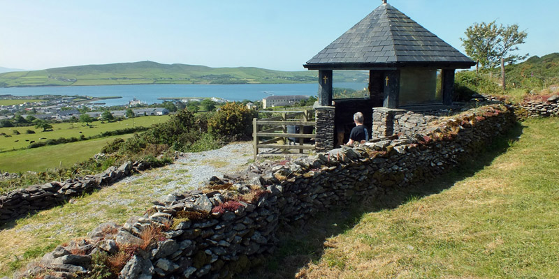 |
Famine Cemetery Kiosk
 |
Soup Pot
 |
Famine Cemetery
 |
Famine Cemetery
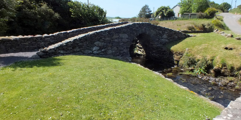 |
Garfinny Bridge
 |
Garfinny Bridge
 |
Road
 |
Bín Bán
 |
Bín Bán
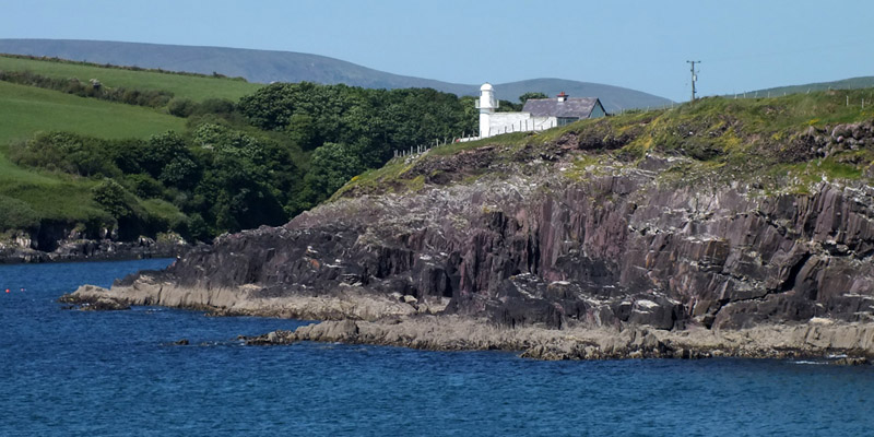 |
Dingle Lighthouse
 |
Eask Tower
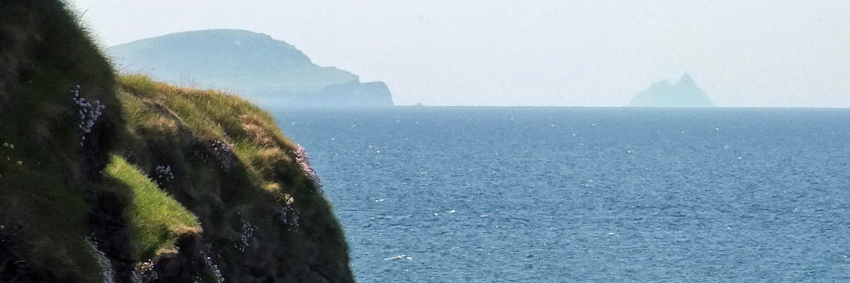 |
Skellig Michael
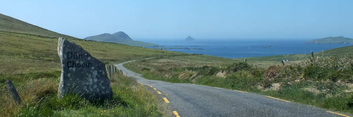 |
Dunquin
 |
The Great Blasket, Beginish, Tearaght
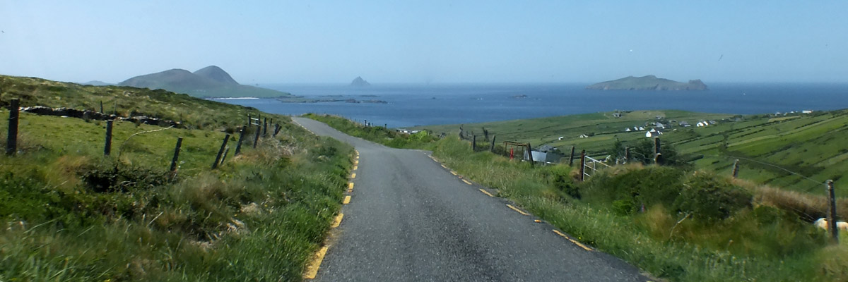 |
The Great Blasket, Tearaght, Inishtooskert (The Sleeping Giant)
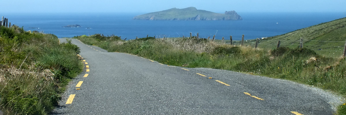 |
The Sleeping Giant
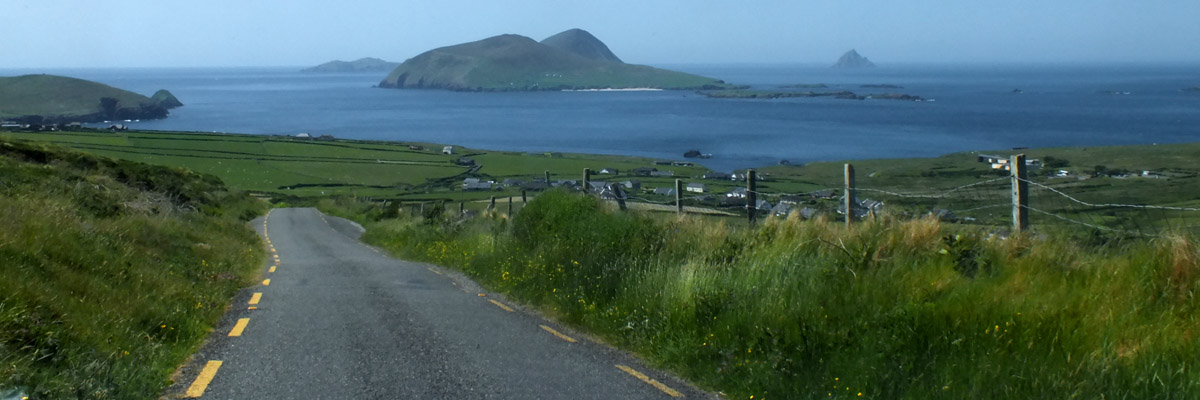 |
The Great Blasket
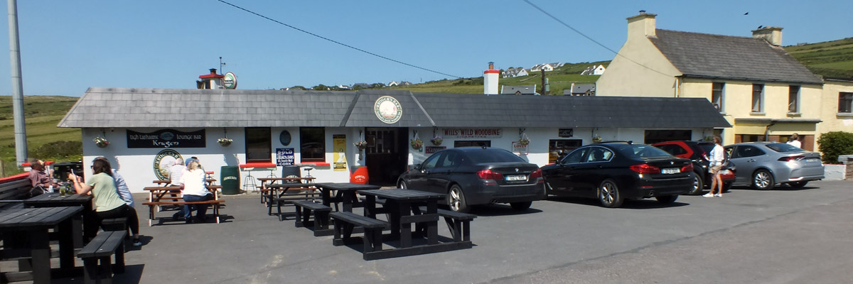 |
Kruger's
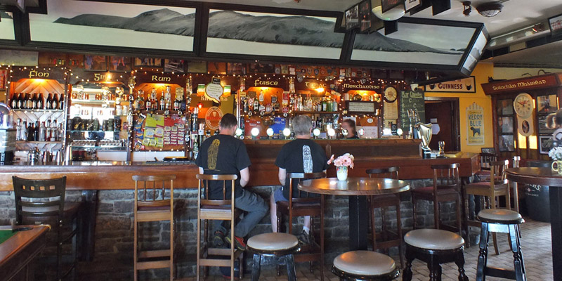 |
Kruger's
 |
Clogher Strand
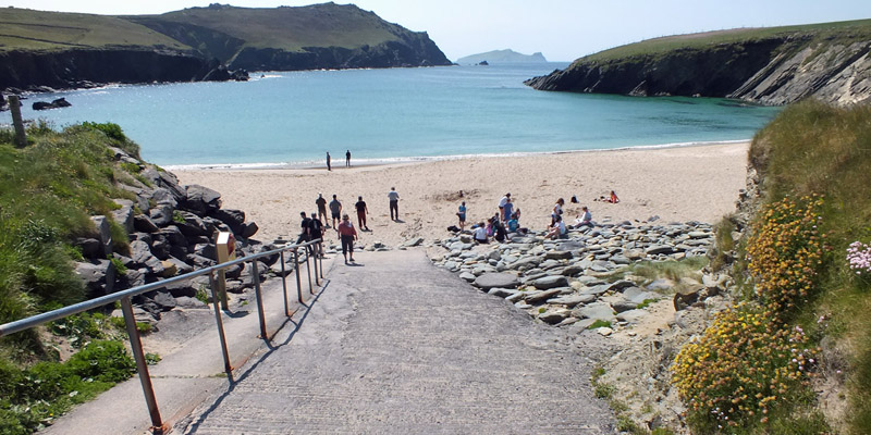 |
Clogher Strand
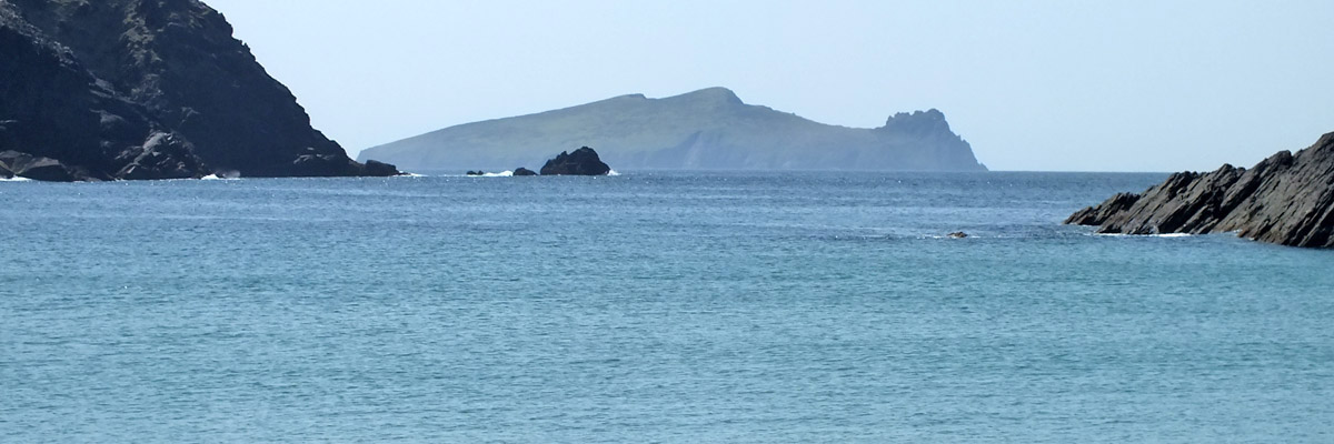 |
The Sleeping Giant
 |
Ballyferriter
 |
Church Of St Vincent
Next
| May | June |
| S | M | T | W | T | F | S |
| 29 | 30 | 31 | 1 | 2 | 3 | |
| 4 | 5 | 6 | 7 | 8 | 9 |
The North Atlantic Arc Home
Mr Tattie Heid's Mileage
Results may vary
MrTattieHeid1954@gmail.com