The North Atlantic Arc Home
Iceland • Faroe Islands • Shetland • Orkney • Norway
|
In 2001, I visited the Faroe Islands, an archipelago lying roughly
halfway between Shetland and Iceland, at about 7°W and 62°N. Føroyar (to give
the place its native name) is an autonomous country within the Danish kingdom,
like Greenland, and Danish is widely spoken, as is English. The native Faroese
language is, like Icelandic, derived from Old Norse. The islands are rugged,
with tiny villages clinging to the cliffs at the edge of the sea, and the
economy revolves around fishing and, increasingly, oil exploration. There is not
a lot of tourism. Tórshavn is the capital and largest town, with a population of
about 17,000 (and the beginnings of suburban sprawl, insofar as it is possible).
Klaksvik, on the northeastern island of Borðoy, is the second largest, with a
population of about 5,000.
I flew from Aberdeen into the airport on Vágar. It's a bit of a drive to Tórshavn--the airport was placed in one of the few areas in the islands with enough (relatively) flat ground for a runway. At the time, a short ferry hop from Vágar to Streymoy, the island on which Tórshavn sits, was also necessary. A tunnel has replaced this. Føroyar is riddled with tunnels, made necessary by the rugged topography, and financed by a grudging Danish government. As my flight arrived at about 10pm, I elected to stay at the little airport hotel the first night, and begin my exploration in the morning. |

|
| When I awoke, I drew back the curtains and saw morning twilight on Sørvágsfjørður. At breakfast, I watched the sun's first rays strike Mykines, the island on the horizon. This multi-image panorama was taken from a point a short distance down the fjord. |

|
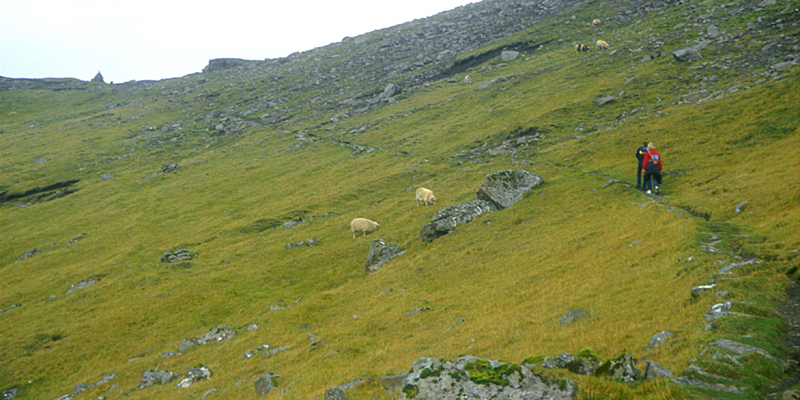
| This panorama was taken from the end of the road--I've driven away from Tórshavn. I was hoping for good weather on this particular day, as I had a hike in mind, and I got a spectacular morning. It wouldn't be this sunny again the rest of the trip. The trail I intended to follow ascends along the edge of the cliff at right. |
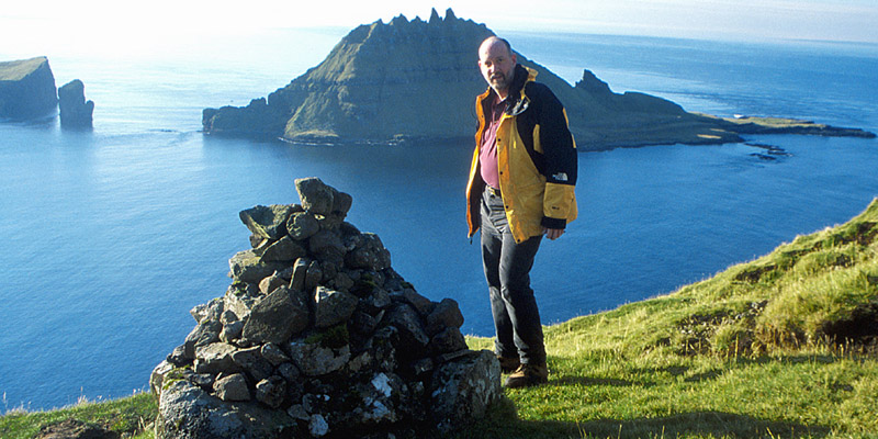
|
| It's hard work hauling that belly up the side of a mountain. The initial ascent was only about 1,000 or 1,200 feet, but it was steep, and slow going for me. The reward was this view. The peculiar spiny islet behind me is called Tindhólmur. |

|
| This telephoto view of Tindhólmur, with a fishing boat in the foreground, gives an indication of its true size. |
|
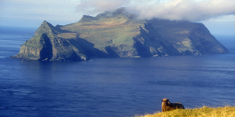
| Most of the tourists who do come to the Faroes in the summertime are birders, and Mykines is a popular destination. It's possible to go there by boat, but there is regular helicopter service, and that is the more usual mode of transport. A wandering local seems to be a bit camera-shy. |
|
| The trail levels out for a distance, and then ascends gently toward the ridge. This photo was actually taken on the return, when a light blanket of cloud drifted over. I passed a Danish couple going the other way. |

|
| The reward: a view of Gásadalur, the most remote village in Føroyar, consisting of ten houses. There are three ways to get here--the way I just came, by helicopter, and by sea. High cliffs at the water's edge make boat access difficult. There had been talk of building a tunnel not long before I was there, but it was decided that it wasn't worth the expense to serve the handful of residents. Don't ask me what they do for a living--sheep farming is the only thing I can think of. Apparently the postman makes the same hike I did once a week. Must be tough at Christmas. I thought about descending to the village, but I'd only have to have come back up. It's not like there was a pub down there or anything. [A tunnel was finally built in 2004, leading Gásadalur's dwindling population to stabilize at 18 or so. The rationale is keeping this valley in agricultural use, such farmland being at a premium in the islands.] |

|
| Back on the road, I passed through the village of Bøur, along the shore of Sørvágsfjørður. |

|
| Another view of Bøur, actually two photos stitched together. |

|
| The town of Sørvágur, at the head of Sørvágsfjørður. The airport is just over the hill. I watched a plane fly up the fjord and then crab slightly sideways at the last moment to line up with the runway, and was glad it had been dark when we'd landed the night before. |

|
| Detail of above. The green embankment to the right of the white building on the waterfront is the edge of a soccer pitch, built on fill out into the harbor--there's nowhere else flat enough! |
|
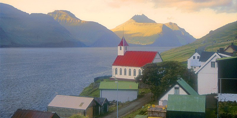
| I think this village is on Sundini, the strait between the islands of Streymoy and Eysturoy, but I couldn't tell you which one it is. |
|
| Tjørnuvik lies at the end of the road at the northern end of Streymoy. Most unusually, it has a beach, of gold-flecked black sand. |
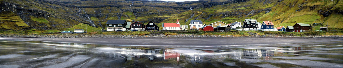
|
| Tjørnuvik from the beach. |
|
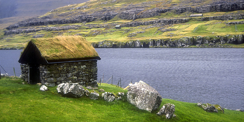
| A sod-roofed shack, somewhere, anywhere. I think the lawnmower fell off partway through the job. |
|
|
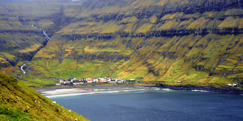
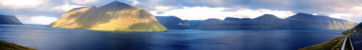
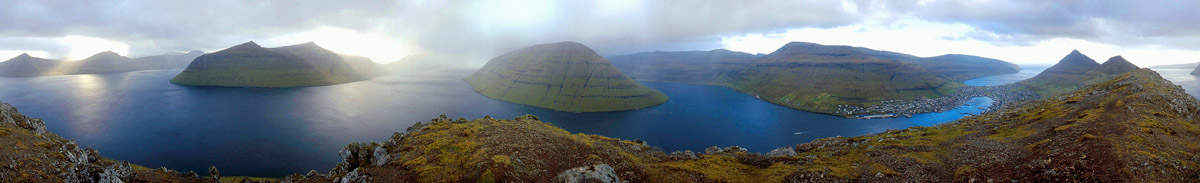
From Leirvik, at the
eastern end of Eysturoy, the ferry runs to Klaksvik, on Borðoy. When I was
there, a tunnel was under construction which would eventually eliminate the
ferry. It's a shame, because the half-hour ferry ride was probably one
of the most beautiful in the world.
This photo was taken from the vicinity of Leirvik. The sunlit headland is the southern tip of Kalsoy, actually a long and slender island. A single road runs the length of it, popping in and out of tunnels; thus, the island is known colloquially as The Flute. The ridge of land to the right is a spur of Borðoy. Through the gap between them, you can see the southern headland of Kunoy. When the ferry entered that gap, all sight of civilization was lost, save the ferry itself. For ten minutes or so, you were in another world, on a little rectangle of water surrounded by rugged mountains. Stunning. I suppose the tunnel is a great aid to the economy of Borðoy. Anyway, I'm glad I got to take the ferry once before they shut it down. |
|
|
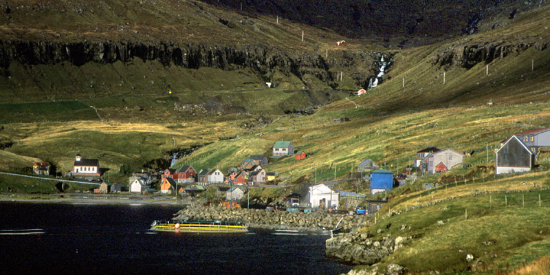
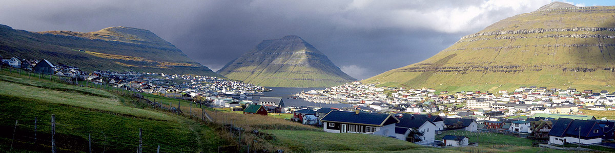
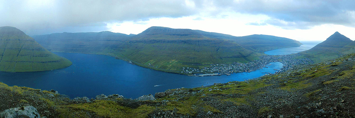
This is Klaksvik, the second largest town in Føroyar. The
headland guarding the entrance to the harbor is the southern end of the island
of Kunoy. It's all fishing, all the time here. You can tell because the menu of
the one restaurant I ate at featured steak, steak, steak, steak, steak, steak,
steak, steak, and lamb. (They were out of lamb.) I didn't have a chance to try
the other restaurant, but I gather that folks here just wouldn't dream of going
out to eat fish.
There was also one dingy, smoky little pub, frequented only by disreputable characters (like me). You can see the scar of a landslide on the hillside to the right. It happened just a year before. My landlady, Olga, told me that a woman in the house below that slide heard a rumble, grabbed her young child, got out, and ran down the street. Minutes later, her husband, who had been working down the street in the other direction, arrived to find his house destroyed and his family nowhere in sight. Imagine his relief a few moments later, and how little he must have cared about the house. [As of 2015, that scar is still visible in satellite photos.] |
|
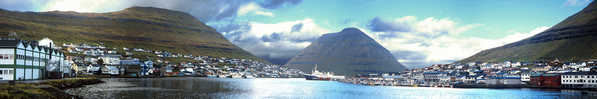
| A panoramic view from the head of the harbor. The large building at the left is Føroyar's brewery. Why it is in Klaksvik rather than Tórshavn, I couldn't guess. The peak to the left is the lowest of several along the ridge to the west of town. |
|
|
It may be the lowest, but it has the best view! This is a 360° panorama from the
summit. A road runs up almost to the saddle between this and the peak to the south,
and it's a relatively easy walk up from there.
Leirvik, the other end of the ferry run, is just visible on the shore of the land on the horizon to the left, almost behind Kalsoy. |
|
| Detail of above. |
|
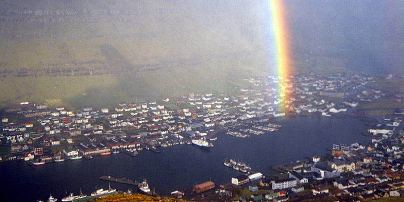
| One is exposed up here, though, and there isn't much cover to hide behind when a typical five-minute North Atlantic squall blows through--a rock here or there. Your reward, however, is a spectacular rainbow. The ferry on which I arrived is still at the dock. |
|
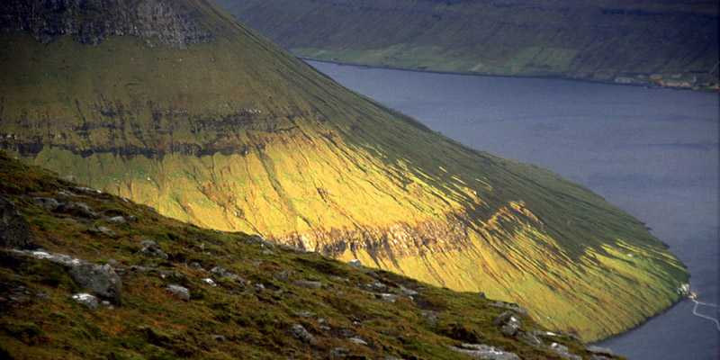
| Kunoy basks in the late-afternoon sun. |
|
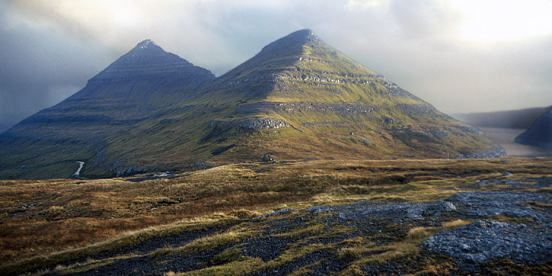
| Am I being suggestible? Just because they're called the Faroe Islands, should these peaks look like pyramids? You can see the road coming up the side of the hill, and if you look real close, you can see where my rental car is parked. |
|
| The village of Kunoy on the island of Kunoy. When I picked out this photo for use here, I assumed that I'd processed it to look like a watercolor painting. Wanting a straight photograph, I found the slide and rescanned it. Turns out that's just how it looks. The land across the water is Kalsoy. |
|
| Okay, I am being suggestible. There's the Sphinx. |

|
| The Faroese have paper money, pegged to the Danish kroner. They use Danish coins, but don't bother with any below one kroner (about sixteen cents US)--nothing's that cheap in Føroyar! The names of the eighteen major islands are engraved in the spirals at the top and bottom. |

|
| A view of the Tinganes peninsula in Tórshavn, and the harbor, from the hill behind the town. |
|
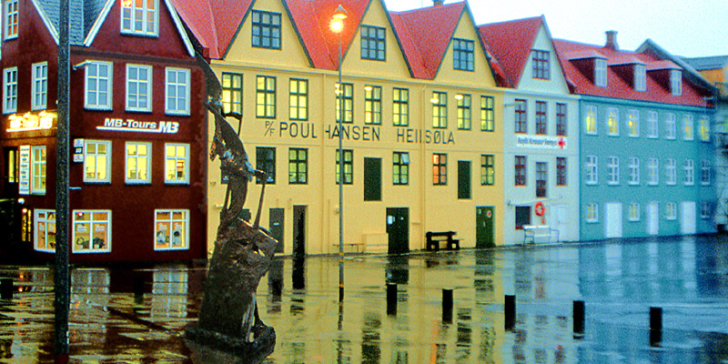
| Downtown Tórshavn on a rainy day. I didn't see much sun after that first wonderful morning, but the day I left was the first really miserable one all week. |
|
|
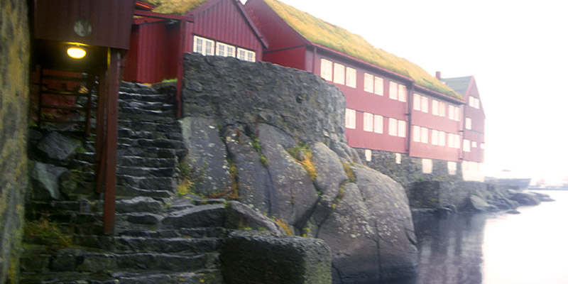
Try a little
Tinganes. The oldest part of Tórshavn. I'd love to return to Føroyar some day; there are a number of things I didn't get to. At the northern end of Viðoy are sea cliffs, said to be the highest in the world. It's a fairly rugged hike to get to where you can see them. There are several museums in Tórshavn that looked to be interesting. There are two fairly large southern islands, Sandoy and Suðuroy, that I didn't get to. And while I did see the medieval site of Kirkjubøur, it was very late in the last day I was there, and I wasn't able to spend the time I would have liked, or get any good photographs. But more than likely, this was a once-in-a-lifetime visit, and the memories I have will have to suffice.* Føroyar, remote and rugged as it is, is a memorable place indeed. Fin *It took fifteen years, but return I did in 2016. |
The North Atlantic Arc Home
Mr Tattie Heid's Mileage
Results may vary